


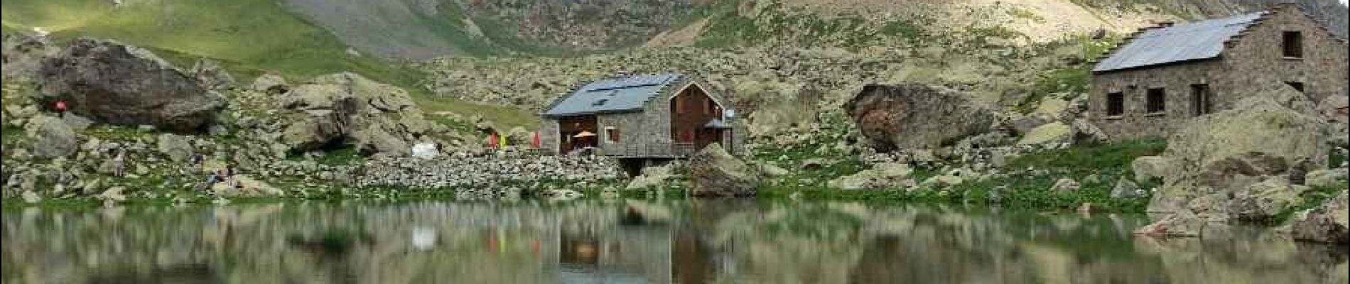
Valgaudemar - Gioberney Refuge de Vallonpierre - 16km 850m 5h35 - 2018 07 03 - public

Orcal37
User GUIDE
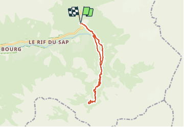

Length
16 km

Max alt
2290 m

Uphill gradient
852 m
Km-Effort
27 km

Min alt
1518 m

Downhill gradient
862 m
Boucle
Yes
Creation date :
2019-01-15 12:32:36.386
Updated on :
2021-09-09 16:05:42.052
7h35
Difficulty : Difficult

FREE GPS app for hiking
 SityTrail
IGN / Geographical institutes
SityTrail Plus
The world is yours!
About
Trail Walking of 16 km to be discovered at Provence-Alpes-Côte d'Azur, Hautes-Alpes, La Chapelle-en-Valgaudémar. This trail is proposed by Orcal37.
Description
Valgaudemar - de Gioberney (du parking du Crépon) au Refuge de Vallonpierre - 16km 850m 5h35 - 2018 07 03 - public
Photos


Positioning
Country:
France
Region :
Provence-Alpes-Côte d'Azur
Department/Province :
Hautes-Alpes
Municipality :
La Chapelle-en-Valgaudémar
Location:
Unknown
Start:(Dec)
Start:(UTM)
285194 ; 4968282 (32T) N.
Comments